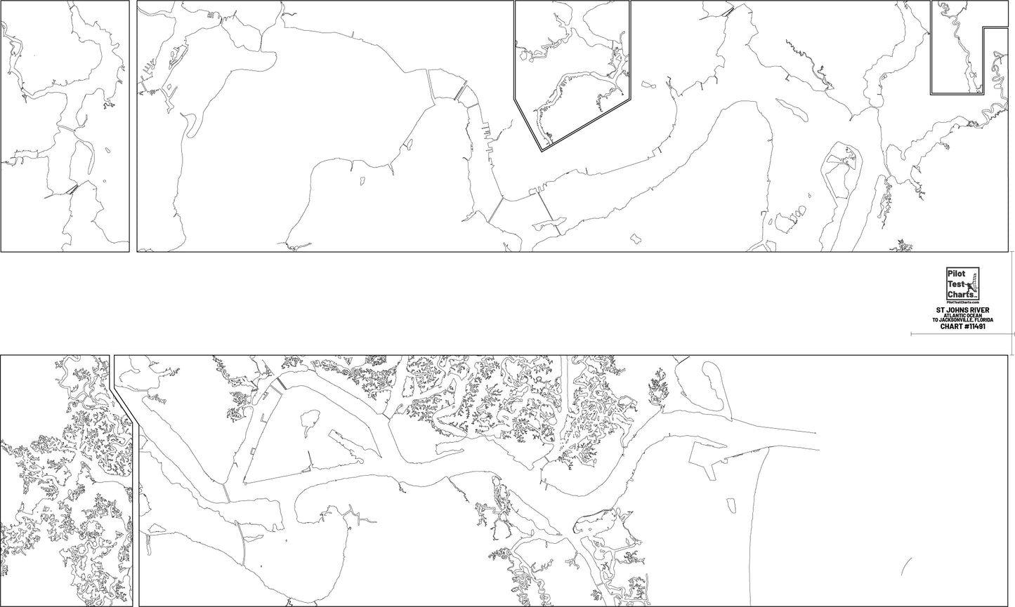
Pilot Test Charts
#11491 St Johns River, Atlantic Ocean to Jacksonville Florida Chart
Couldn't load pickup availability
Share
#11491 St Johns River, Atlantic Ocean to Jacksonville Florida Chart
Vellum Paper Test Chart
-Port Pilotage test chart
-Transparent vellum paper
-Best for use as test chart for USCG testing
-Chart file is most recent and updated version
-Paper has good transparency
-Marks well with pencil with low smudge factor
-Pencil lead erases well
-Base print has fine line detail
-Meets USCG paper requirements for pilotage test
White Paper Practice Chart
-Port pilotage practice and study chart
-Most economical for repetition studying
-Not for USCG pilotage testing (practice and study only)
-Base print has fine line detail
-Chart file is most recent and updated version
-Non-transparent white bond paper
-Printed on 32# premium bond paper
NOAA Chart
-Full size NOAA Chart
-Full color
-Printed on 32#, non-transparent, premium White bond paper
Overlay Chart
-Printed on clear plastic mylar (like overhead projector material)
-Full color print
-NOAA chart file
-Used for grading your own Test Charts or Practice Charts
11" x 17" Chartlet Pack
- Individual, segmented chartlets of entire pilotage route
- Best for repetition studying
- Great for studying at standard size desk or table (no need for chart table)
- Printed on White Paper (32# Bond)
![#11491 St Johns River, Atlantic Ocean to Jacksonville Florida Chart](http://pilottestcharts.com/cdn/shop/files/St_Johgns_River_Atlantic_Ocean_To_Jacksonville_FL_11491_PRODUCT_PHOTO.jpg?v=1710361546&width=1445)
![#11491 St Johns River, Atlantic Ocean to Jacksonville Florida Chart](http://pilottestcharts.com/cdn/shop/files/StJohgnsRiver_AtlanticOceanToJacksonvilleFL_11491PRODUCTPHOTO.jpg?v=1710361607&width=1445)
![#11491 St Johns River, Atlantic Ocean to Jacksonville Florida Chart](http://pilottestcharts.com/cdn/shop/files/StJohnsRiver_AtlanticOceantoJackasonville_.FloridaNOAAChart_11491PRODUCTPHOTO.jpg?v=1710361606&width=1445)
![#11491 St Johns River, Atlantic Ocean to Jacksonville Florida Chart](http://pilottestcharts.com/cdn/shop/files/StJohnsRiver_AtlanticOceantoJackasonville_.FloridaOverlayChart_11491PRODUCTPHOTO.jpg?v=1710361607&width=1445)
![#11491 St Johns River, Atlantic Ocean to Jacksonville Florida Chart](http://pilottestcharts.com/cdn/shop/files/ChartletPackExampleImage_0295f118-40a2-43a8-9321-5949c6369125.jpg?v=1710361608&width=1445)
![#11491 St Johns River, Atlantic Ocean to Jacksonville Florida Chart](http://pilottestcharts.com/cdn/shop/files/St_Johns_River_Atlantic_Ocean_to_Jackasonville_._Florida_NOAA_Chart_11491_PRODUCT_PHOTO.jpg?v=1710361546&width=1445)
![#11491 St Johns River, Atlantic Ocean to Jacksonville Florida Chart](http://pilottestcharts.com/cdn/shop/files/St_Johns_River_Atlantic_Ocean_to_Jackasonville_._Florida_Overlay_Chart_11491_PRODUCT_PHOTO.jpg?v=1710361547&width=1445)
![#11491 St Johns River, Atlantic Ocean to Jacksonville Florida Chart](http://pilottestcharts.com/cdn/shop/files/ChartletPackExampleImage_47e55ce4-8f1d-459f-873e-fe8443280b63.jpg?v=1710027392&width=1445)